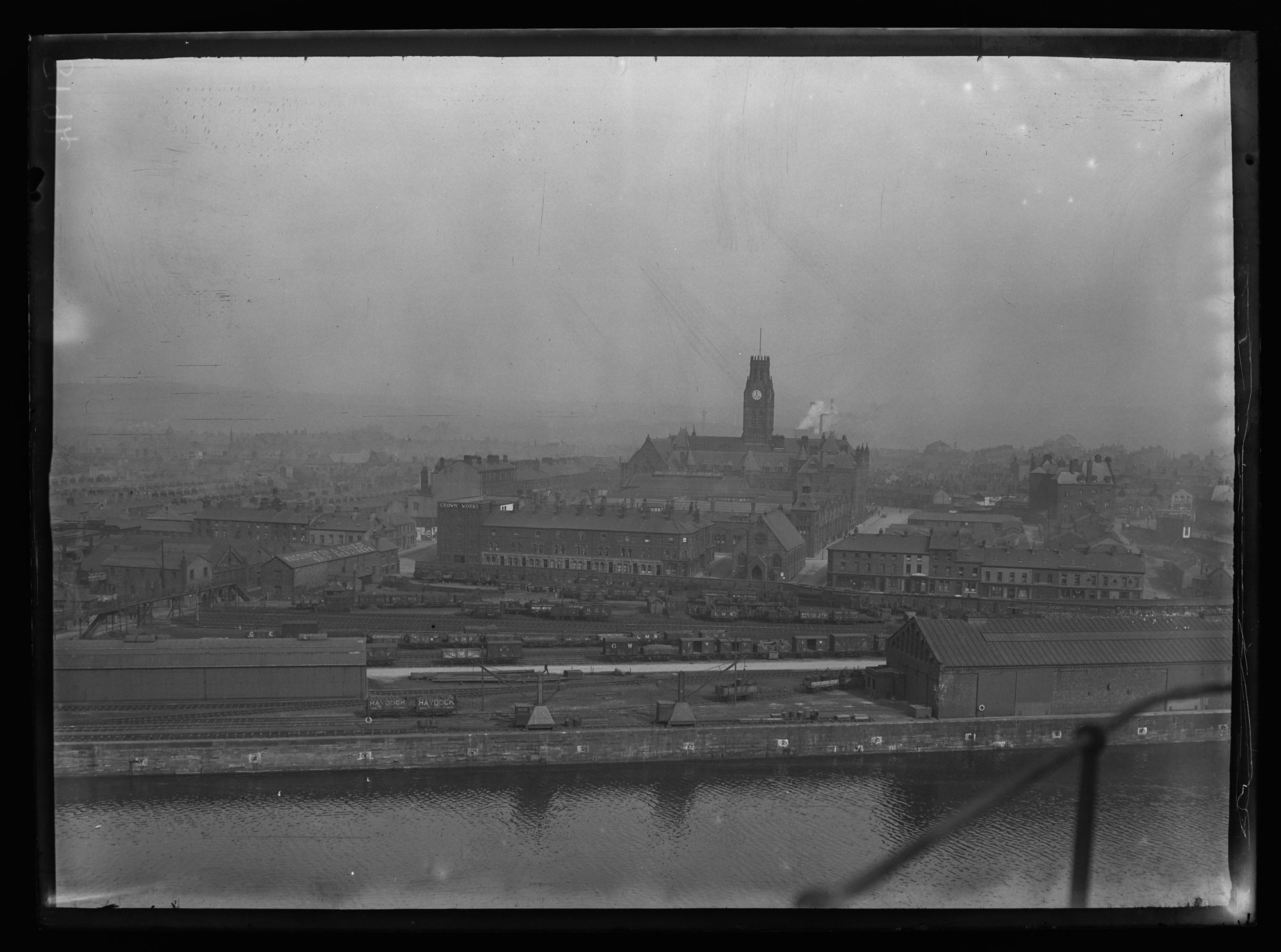
Barrow was targeted during World War II because of the strategic importance of the shipyard and steelworks. The Sankey image shows the view from the top of Vickers main crane looking towards the town hall clock situated only 400m away.
With a population of approximately 60,000 living in densely packed Victorian terraced housing – close to key industrial areas – it was inevitable the town’s population would suffer greatly. It is estimated that overall, approximately 100 civilians were killed, hundreds more injured, and a large percentage of its housing destroyed or damaged. An article in the Evening Mail, 21st October 1944, headed ‘Air Attacks Killed 92 in Barrow’, and ‘Houses Damaged Rivalled Coventry’ gave details of a report on damage to the town.
- Houses demolished during raid: 118
- Houses subsequently pulled down: 500
- Houses seriously damaged but repaired: 1364
- Houses slightly damaged: 9382
The article stated: ‘Altogether 11,384 houses were damaged in Barrow, the proportion being as high as most of the heavily bombed towns of the country including Coventry due to the heavy calibre of missiles used.’
The Luftwaffe mainly used three types of bombs on Barrow, mostly dropped at night. Using the “Lorenz beam system” to navigate to its target, pathfinder aircraft would normally drop incendiary bombs to guide others into the target area.
Depending on the bomb type, the aircraft would set up at a predetermined altitude/heading, dropping its bombs in a straight uniform manner. This can be clearly seen from a map of bombs that fell on Barrow.
- High Explosive dropped 86
- Land Parachute Mine dropped 34
- Incendiary dropped 1300
Barrow, like other Luftwaffe target locations, set up defensive strategies eg. air raid shelters (public and private), anti-aircraft guns, barrage balloons, and decoy sites such as at Sandscale and the south end of Walney. Looking at the bomb map and the amount of ordnance dropped around Bigger Village, the decoy strategy had a limited amount of success.